PHOTOGRAPH BY SIMONE FRANCES FROM OLD SANTA FE TODAY, 5TH EDITION
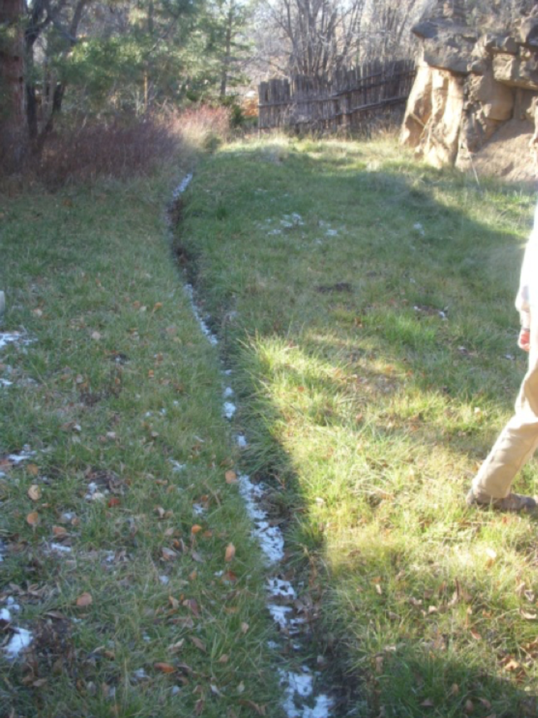
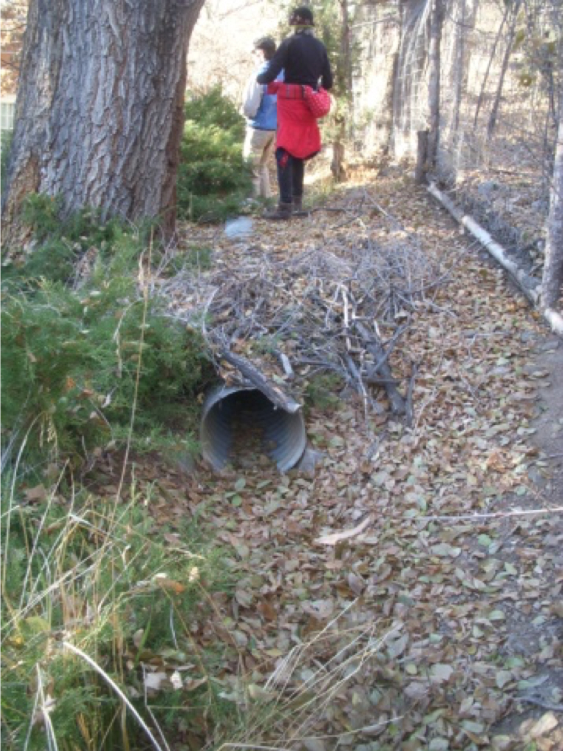
Constructed over 400 years ago, the Acequia Madre, or Mother Ditch, transports precious water to Santa Fe from the Sangre de Cristo Mountains. The Spanish brought ditch technology and regulation procedures of Arabic origin to New Mexico from Spain, where they used acequias to irrigate similarly arid terrain. Shortly after settlers arrived in Santa Fe, they dug the Acequia Madre, and its companion the Acequia de la Muralla, on the northern wall of the old presidio along today’s Hillside Avenue, to supply water for domestic use and crop irrigation to residents. Both the Acequia Madre and the Acequia de la Muralla continue to run, though at a reduced rate. Homeowners along the acequias must understand that caring for their section of acequia affects the flow of water to neighboring properties and to the community. Historically, communities built acequias along with other communal structures such as churches, emphasizing the significance of shared experience and collaboration.
From Old Santa Fe Today, 5th edition by Audra Bellmore with photographs by Simone Frances.
![The diversion structure for the Acequia de la Muralla, showing the Santa Fe River in the front left, the sandbag wall, the headgate, and the opened culvert that is the beginning of the ditch. photo by B.C. Rimbeaux](https://images.squarespace-cdn.com/content/v1/5772daf0b3db2b0a27ef10f8/1516296698025-4PDWFJMRDWNOHM99RC7G/AcequiaMuralla1.jpg)
![The acequia diversion prior to the addition of the new headgate. photo by Martin Kuziel](https://images.squarespace-cdn.com/content/v1/5772daf0b3db2b0a27ef10f8/1516296858851-VWD96DEDPH25DRE5IRBT/AcequiaMuralla2.jpg)
![The drop today in the level of the river at the headgate. photo by the Deborah and Jon Lawrence](https://images.squarespace-cdn.com/content/v1/5772daf0b3db2b0a27ef10f8/1516296990675-GFR35SC1RM8YFC03GXES/AcequiaMuralla3.jpg)
![The fence between Armijo Park and the property at 1400A Cerro Gordo. The board controls flow into the acequia, which continues into the private property, or into the ditch on the left which shunts the water back into the river. photo by the Debora](https://images.squarespace-cdn.com/content/v1/5772daf0b3db2b0a27ef10f8/1516297200865-7T222DB9RH8ENS2M41MH/AcequiadelaMurella4.jpg)
![Berm holding the acequia. photo by the Deborah and Jon Lawrence](https://images.squarespace-cdn.com/content/v1/5772daf0b3db2b0a27ef10f8/1516297376974-LATDO7BCH5YUNJ5W5KA2/AcequiadelaMurella5.jpg)
![The lateral running into the field at 9 Camino Pequeño. photo by the Deborah and Jon Lawrence](https://images.squarespace-cdn.com/content/v1/5772daf0b3db2b0a27ef10f8/1516297485432-XTD6EHQ6JL34QU9IZNG5/AcequiaMuralla5_Vertical.jpg)
![A concrete plug once used to control diversion into a former lateral. photo by the Deborah and Jon Lawrence](https://images.squarespace-cdn.com/content/v1/5772daf0b3db2b0a27ef10f8/1516297622818-47D2QPHZW0RTF2NPH434/AcequiadelaMurella7.jpg)
![Stonework lining the acequia and entrance to the current lateral at 9 Camino Pequeño. photo by the Deborah and Jon Lawrence](https://images.squarespace-cdn.com/content/v1/5772daf0b3db2b0a27ef10f8/1516297833761-AT3RIX4PFQW04V0I81WB/AcequiadelaMurella8.jpg)
![Gate for a lateral into Stina Badger’s orchard. photo by the Deborah and Jon Lawrence](https://images.squarespace-cdn.com/content/v1/5772daf0b3db2b0a27ef10f8/1516297929681-VZRZAS2EBD157F4QZN0K/AcequiadelaMurella9.jpg)
![Deborah Lawrence and B.C. Rimbeaux where the acequia traverses the grassy section below the embankment behind the Krause house. photo by the Deborah and Jon Lawrence](https://images.squarespace-cdn.com/content/v1/5772daf0b3db2b0a27ef10f8/1516298000616-QJ0ZFV6ZEL3O7AF4QUT3/AcequiadelaMurella10.jpg)
![Narrow section of the acequia in the grassy section behind the Krause house. photo by the Deborah and Jon Lawrence](https://images.squarespace-cdn.com/content/v1/5772daf0b3db2b0a27ef10f8/1516298113426-LJRKDUPMTFFIQBPIO1UZ/AcequiaMuralla11_Vertical.jpg)
![A culvert in the acequia. photo by the Deborah and Jon Lawrence](https://images.squarespace-cdn.com/content/v1/5772daf0b3db2b0a27ef10f8/1516298211250-MWW9YVWNUO9FC4NIVVM1/AcequiaMuralla12_Vertical.jpg)
![Bypass culvert leading to the exit ditch on the right. photo by the Deborah and Jon Lawrence](https://images.squarespace-cdn.com/content/v1/5772daf0b3db2b0a27ef10f8/1516298365276-TNOWPZ5PVUUO2HA8F4J3/AcequiadelaMurella13.jpg)
![The acequia where it emerges from under the road opposite the bypass culvert. photo by the Deborah and Jon Lawrence](https://images.squarespace-cdn.com/content/v1/5772daf0b3db2b0a27ef10f8/1516298393304-AXU2SL1RMQBXRSLKZ41K/AcequiaMuralla14_Vertical.jpg)
PHOTOGRAPHS COURTESY OF BC RIMBEAUX